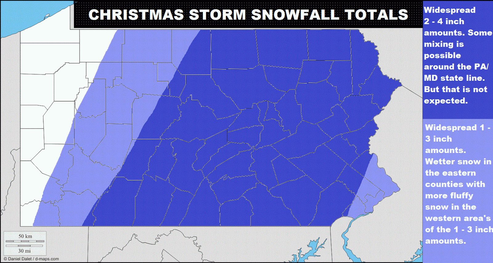
So, here is a summary of this Christmas eve - Christmas day storm. This storm will come in from the south and it will go up the coast. This will spread a good healthy area of snow throughout area's in the northeast, like Pennsylvania. This storm could start out as a mix around the extreme southern counties of Pennsylvania, or the southeastern counties. This storm will overspread the region wit snow late Christmas eve, giving snow to the majority of the area. Like I said, there could be a few area's of sleet or even rain in counties like Philadelphia and Bucks. The snow will continue to fall through the night and could be heavy at times. The storm should be wrapped up at about early mid-day Christmas, (Tuesday). This storm should put down amounts of 2 - 4 inches in the dark blue area's and possibly an area up to 5 or 6 inches. Models are leaning towards possibly heavier amounts possible in counties like Franklin, Adams, York, and Lancaster. Right after this storm, there will be a much more significant storm on around Wednesday - Friday. Even though the euro went warmer today, I think it went through convective feedback issues. This storm is likely to be all snow for everyone and most models are saying a foot plus in central and eastern Pennsylvania. I will have updates on these two storms constantly. Stay safe and be sure to check back for the latest forecasts and outlooks!
Very nice map
ReplyDelete